What does the land at
Diddly Squat Farm say?
An independent, six-minute terrain read of Jeremy Clarkson's farm: from a 2 m national elevation model, satellite imagery, and a decade of climate data. This is what it says.
This property presents an unusually generous canvas: 395 hectares of gently-graded Cotswolds land, 97% of it cultivable (385.5 ha), with a 3.6 million m² buildable zone and three natural water-collection points, more than any other parcel in our sample set. It reads exceptional on terrain, tighter on climate (cool summers, 5 m/s mean winds), and workable on water: the rain is abundant and spread across twelve months, but the farm is 70% of its own catchment, so it largely makes its own water rather than receiving it.
Curious what your own parcel scores?
Terrain & Building
Elevation spans only 90.4 m of elevation across its full extent, and the maximum approach grade, the steepest pitch on the gentlest route in from the boundary to the main building ground, is under 1%: essentially level by rural-land standards, and drivable by an ordinary passenger vehicle. Largest contiguous buildable zone, under 7° of slope, covers 362.8 ha, about 92% of the entire farm. Genuinely level ground, under 2°, covers 122.0 ha, the largest single patch 59.5 ha and orders of magnitude larger than any single structure needs, giving near-total freedom in siting buildings, lanes, and infrastructure. Drainage from these pads is good: rainfall sheds rather than ponds. The 5 m/s annual mean wind, with a clear dominant direction, means orientation matters: shelter living spaces from the prevailing quarter, and plant windbreaks before pouring foundations. Terrain & Building scores 91/100, Exceptional.
Water
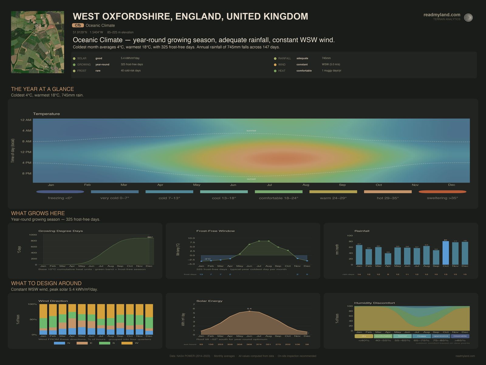
Annual rainfall of 745 mm sits comfortably above the 500 mm threshold below which rain-fed agriculture becomes precarious, and, unusually, this site has zero dry months. October is wettest at 80.8 mm, April driest at 39.3 mm, but even April clears the threshold easily. This is a year-round-moist climate, not a Mediterranean dry-summer regime, which changes the storage calculus: the priority is buffering between wet weeks, not bridging a drought. Three natural pond/dam sites is a modest count for 395 hectares, though more than any other parcel in our sample set: drainage convergence is concentrated and identifiable across the farm, and no other parcel in our sample set offers a single one.
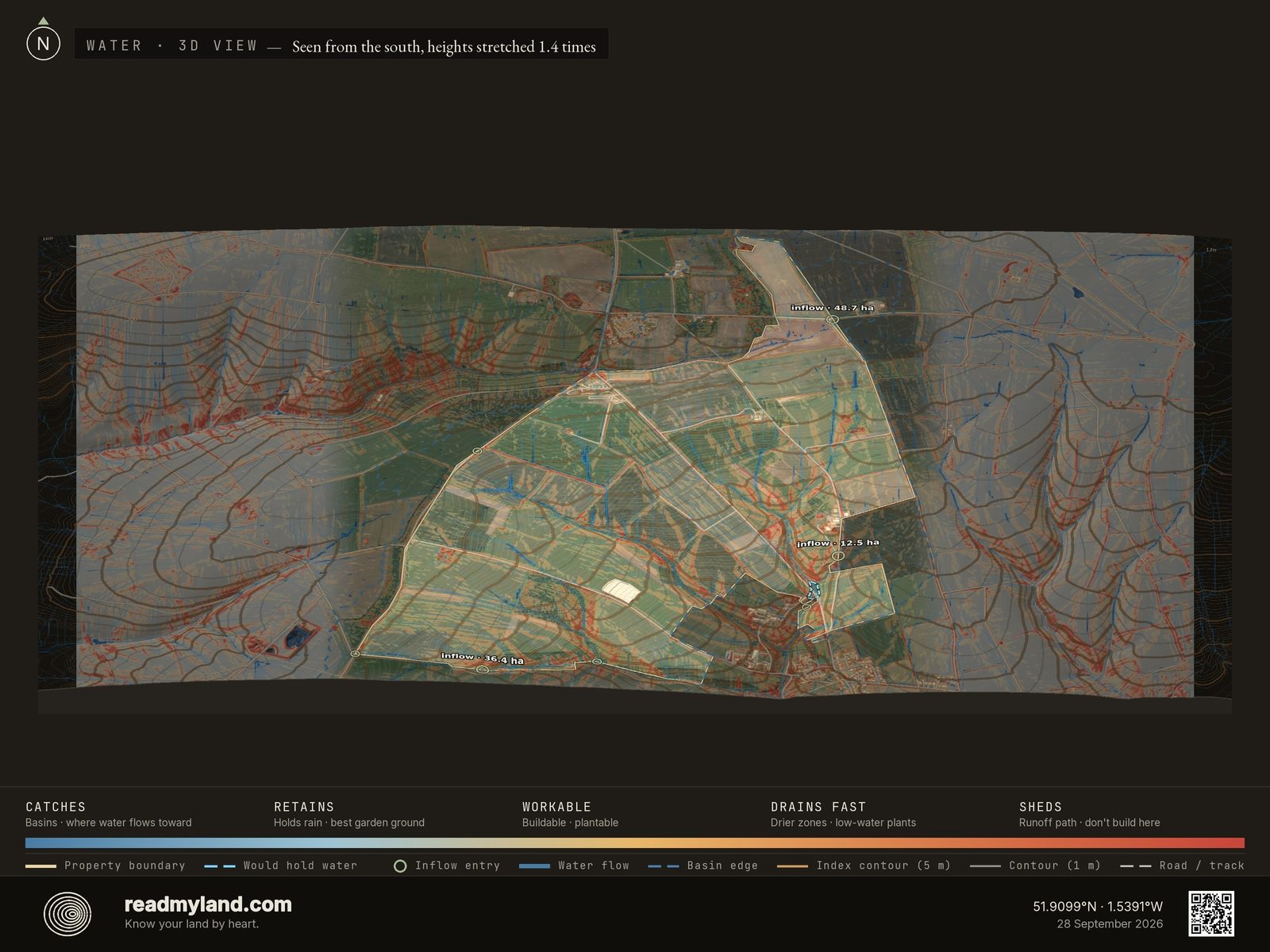
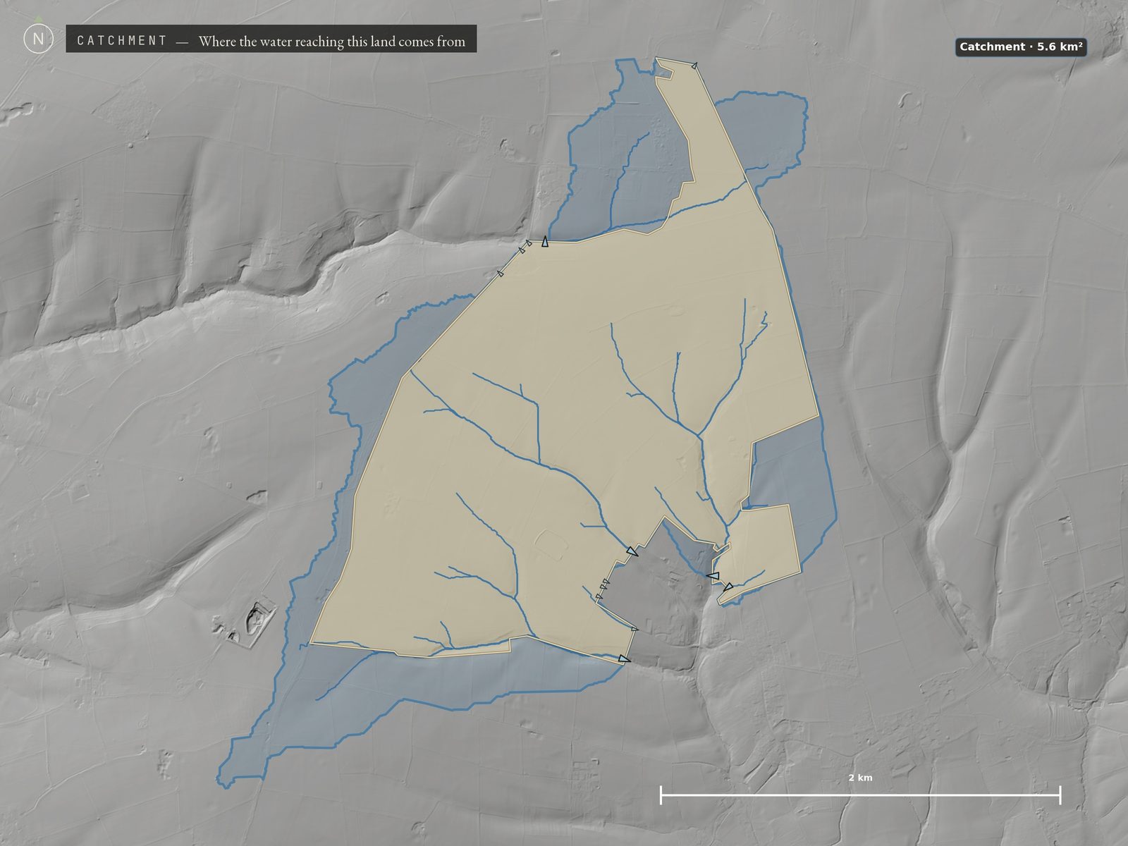
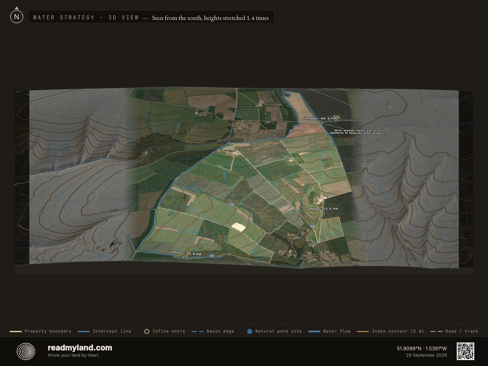
Supply is more nuanced than the rainfall alone suggests. That basin draining through this land covers 563.2 hectares, but the farm is itself 70% of its own catchment: only about 168 hectares of that basin lies beyond the boundary. That is the honest limit on this site: it is a big farm inside a modest basin, gathering most of its water from its own surface rather than from a large upslope area. Water scores 48/100, Workable: the rain is reliable and the pond sites are real, but three of them across 395 hectares is a modest endowment, and storage here is about catching what falls on the farm itself. The three largest inflow points are mapped where they cross the boundary: the Water Strategy plate below marks where to intercept them. The 17.7% of the parcel reading as persistently wet flags where building footprints should be avoided but where willow, alder, and wet-tolerant pasture thrive.
Sun & Growing
60.4% of the parcel falls inside the sun-facing band, southeast through south to west, the wide arc the solar score counts, since panels tolerate more angles than plants do, and terrain shading is minimal, a strong orientation at this latitude. Solar resource averages 3 kWh/m²/day, modest by Mediterranean standards but realistic for a maritime climate; gardens get adequate light through the season and PV is viable if sized larger. Cultivable area (slope under 12°) covers 97% of the parcel at 385.5 ha. With 325 frost-free days and 887 growing degree days, the site supports apple, pear, plum, cherry, soft fruit, brassicas, root crops, and pasture; the growing-degree-day ceiling rules out heat-demanding crops. The soil is the Elmton 1 association: shallow, well-drained, brashy calcareous fine loamy soils over Jurassic Limestone, from the National Soil Map of England and Wales. Topsoil is the balanced loam gardeners want (29.0% clay, 38.7% silt, 32.4% sand), and the survey's own verdict on this ground is freely draining and lime-rich. But depth to rock is just 47.1 cm: that rules out deep-rooted orchard blocks on the shallowest ground without raised beds or imported topsoil, and it is a groundwork wildcard for foundations and septic fields. Test pits before you commit: a 1:250,000 survey names the soil across this landscape, it does not describe this field.
Climate Context
The temperature arc runs from a January average of 3.8°C to a July peak of 17.6°C: a cool-temperate maritime profile. With 325 frost-free days, roughly 40 days a year fall outside the frost-free window, so hardy perennials thrive but tender Mediterranean species need shelter. Drought risk is effectively zero: no month drops below 30 mm, and the wettest and driest months differ by only about 40 mm, a remarkably flat rainfall curve by any standard. What holds Climate to 49/100, Workable is thermal, not hydrological: 887 growing degree days is a modest heat budget, and it is the ceiling on what will ripen here rather than any shortage of water or light.
Risk Assessment
Fire. EU JRC's fire-perimeter archive shows zero recorded perimeters and zero hectares burned within the 99.1 km² surrounding area over the five-year window: reinforced by zero dry months and a cool 17.6°C summer peak. This is a low-fire-load landscape; standard defensible-space management suffices.
Flood. This is the coarser half, and we would rather say so than imply otherwise: no parcel-scale flood-zone register covers this parcel, so it is read from a global ~1 km inundation model (WRI Aqueduct Floods v2) which resolves large rivers and coastlines but not a field drain or a brook, plus the terrain itself. That model places this land outside any large-river or coastal flooding, and the Sources table below names it at its true resolution rather than implying parcel-scale mapping. What the terrain does show: a gentle 90.4 m elevation range with no steep relief to concentrate a flood pulse, 17.7% of the farm reading as persistently wet, and the parcel sitting in the middle third of its basin by elevation, it both receives runoff from the ground above and sheds it to the ground below. Three convergence points mark where surface water concentrates and where footprints should be set back. Fire & Flood Safety scores 70/100, Watch: the fire half is measured and clean, the flood half rests on terrain alone. An on-site hydrology check is recommended before construction.
Key Opportunities & Risks
Three natural pond sites combined with year-round rainfall make on-site water storage straightforward and abundant: a rare combination, and the strongest single feature of this land. 362.8 ha of contiguous buildable, well-drained terrain gives near-total siting freedom for buildings, infrastructure, and intensive cultivation. Against that: the farm is 70% of its own catchment, so plan storage around what falls on the property rather than what arrives from upslope, and intercept the three largest mapped inflow points where they cross the line. Dominant wind (5 m/s mean) calls for a deep-rooted windbreak along the upwind boundary (£20,000–£49,000 including three years of establishment care). And the cool-temperate climate caps the crop list: plan for pome fruit, brassicas, pasture, and cool-season grains rather than Mediterranean staples. This analysis is based on satellite, elevation and national soil-survey data. It does not replace parcel-level soil testing, legal constraints, or factors requiring a site visit. On-site inspection is recommended before purchase or major development.
The layers compute the data; the maps make it readable. Every claim above traces to one of these. Read the note, then the map illustrating it. Ten design maps come with every dossier; the Ruggedness plate, the two catchment plates and the Water Strategy plate below are here because this parcel was read at a fine enough elevation resolution, and had the catchment data and the inflow points, to draw them.
The land as it actually is
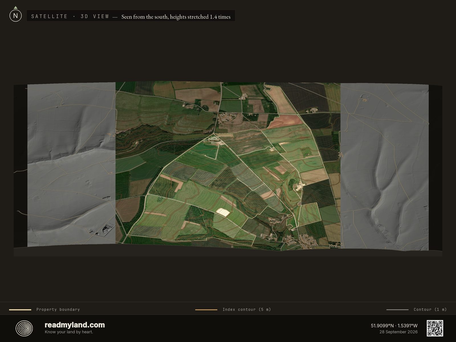
A real aerial view with the boundary and 1 m contours laid over it. What it shows here: open, machine-scale arable fields divided by hedgerows, built areas in three places, a compound in the northwest corner, a lone mid-parcel barn, and the farmstead against the eastern boundary, with the village just beyond the southeast corner. Woodland presses on the western edge but barely crosses the line: nearly everything inside the boundary is open, machine-worked field.

Where water collects, where it drains
Blue is where water gathers; orange drains fast and red sheds runoff. The sage rings on the boundary are where upslope water comes in: the farm's three largest inflow points are labelled with the hectares of ground that feed each, and the small unlabelled rings are the smaller entries. The blue areas are the best candidates for the three pond sites: keep buildings and septic out of them. About 17.7% of the farm reads as persistently wet; the drier ground between the blue suits foundations and access roads.

How much land feeds this one
The full basin that drains through the farm, mapped well beyond the boundary. Here it covers 563.2 hectares and falls 91.5 m end to end, but the farm is itself 70% of it, so only about 168 hectares sits outside the fence line. A big farm inside a modest basin: this land makes most of its own runoff rather than inheriting it. The pale triangles on the farm's edge are its 13 water exits, sized by how much of the land drains to each; the parcel view below labels the three largest.
Where the water actually crosses the line
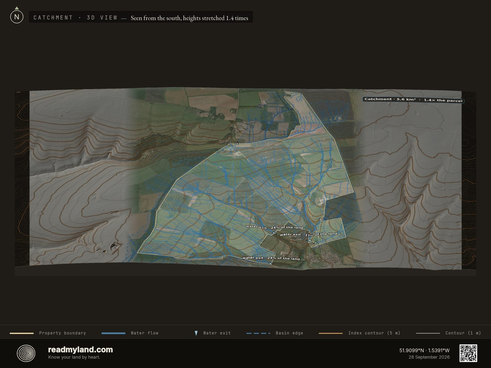
The same basin zoomed to the property. The farm sits in the middle third of its catchment by elevation, the only one of our four samples that does, and it cuts both ways: water arrives from the ground above and keeps moving to the ground below. Where the farm's own water leaves, the map draws a pale triangle: 13 exits, each sized by how much of the land drains to it. The three largest are labelled with their share, all in the south-east where the valley cuts in, and the largest of them leaves westward, off the small eastern field into that valley. Its three largest inflow points are marked on the wetness and Water Strategy plates; here, the heaviest blue lines are the ones to keep buildings and septic well clear of.

Where to catch it, before it leaves
The actionable water read, and the plate this farm earns more than any parcel we've published. The blue intercept line runs round the northern and western boundary and along the western part of the southern edge, where most upslope water enters, and the sage rings mark the entries themselves: the three largest labelled with the hectares that feed each, the smaller ones unlabelled. Each ring sits in a watercourse, so it shows where to intercept water, not where to put a tank. Intercepting water where it arrives, with a swale, diversion drain, or tank inflow, costs far less than moving it later. The head annotation gives how far water from the top entry falls before it leaves: the number that decides whether gravity does the work or a pump does. The three pond sites already in the terrain are the small solid blue dots: each one a point where the flow model says water concentrates, a natural candidate for a dug pond.

The shape of the ground and the path of the rain
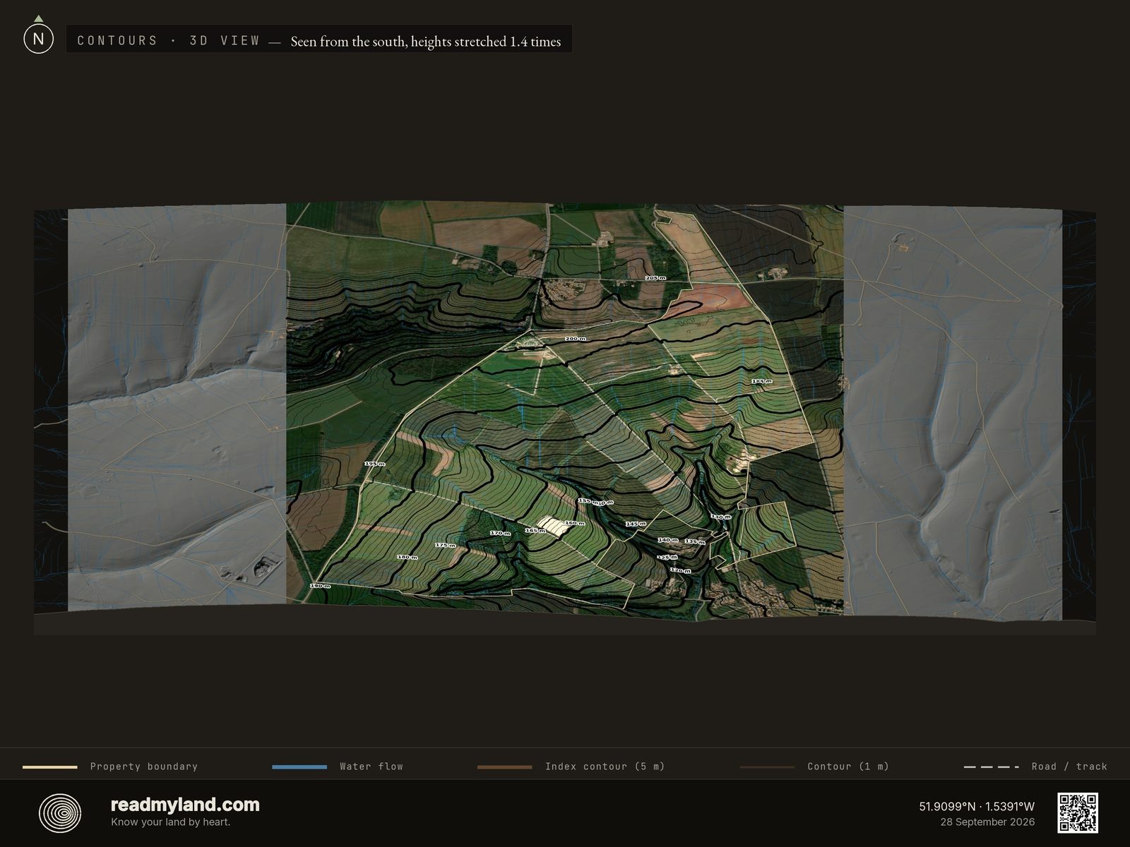
Contour lines over the satellite image, with the water-flow lines in blue. The story here is one long 90.4 m fall from the northern tip toward the village corner in the southeast: wide-spaced lines across the central plateau, then a sudden tightening where the ground drops into the southeast valley. The blue lines converge on that same valley: the largest of the farm's 13 exits sits there, taking 37% of the land's own water, and two more on the southern side take about a quarter each. The wet ground of the earlier maps is spread much wider than this one corner, strung along the smaller creases as well.

Terrain shape on its own
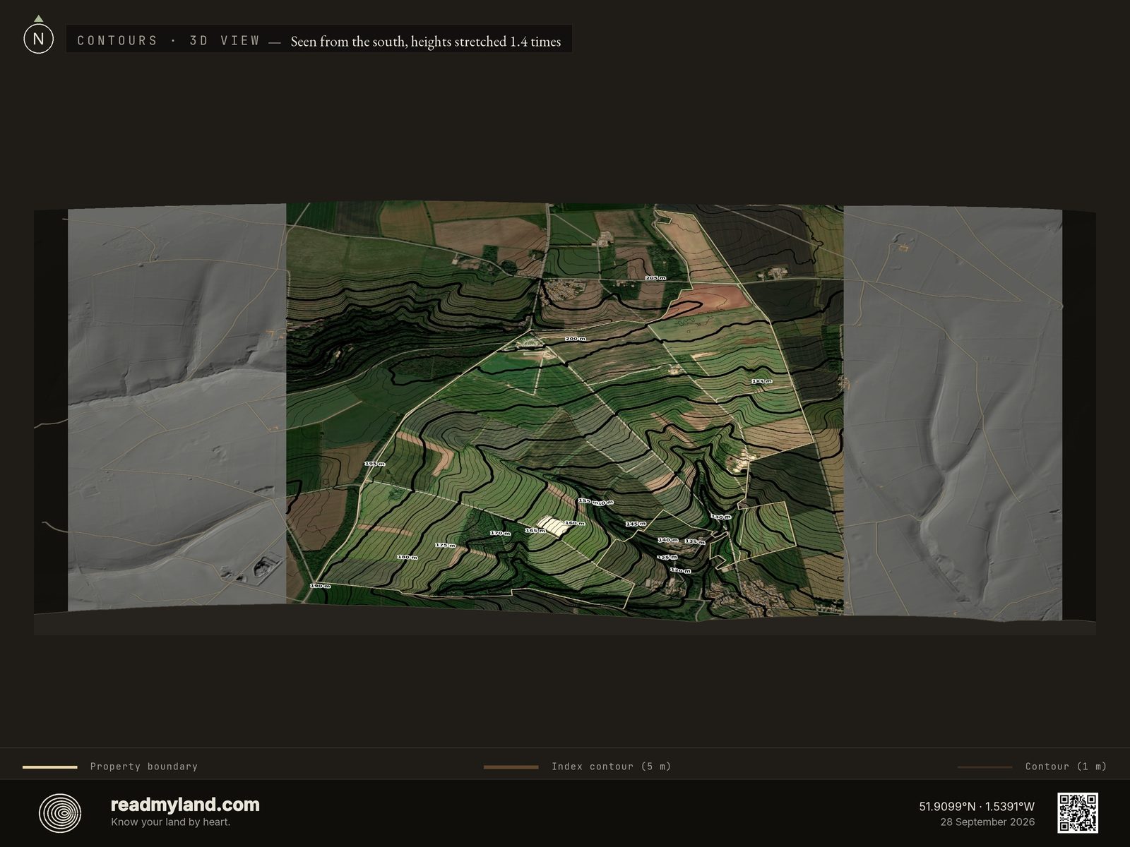
The same contours without the water overlay, and the farm's structure becomes plain: a broad, gently tilted plateau holding almost all of the 395 hectares, with the deepest relief crowded into the southeast quarter where the valley cuts in. If a line of tight contours is a wall, this farm has one that counts, that valley, with a shallower crease system along the southern edge. Everywhere else the spacing stays wide enough to drive, plough, and build.

High ground and frost pockets
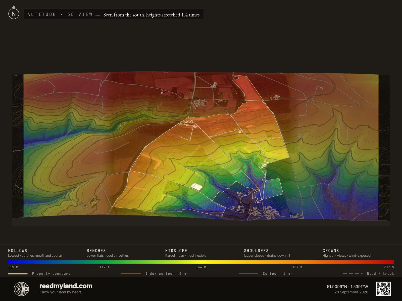
Elevation as a colour gradient from low (blue) to high (red). Low pockets catch cold air and runoff; higher ground drains well and catches the views. Full range here is just 90.4 m: gentle, rolling Cotswolds country with no dramatic relief.

How steep, and how buildable
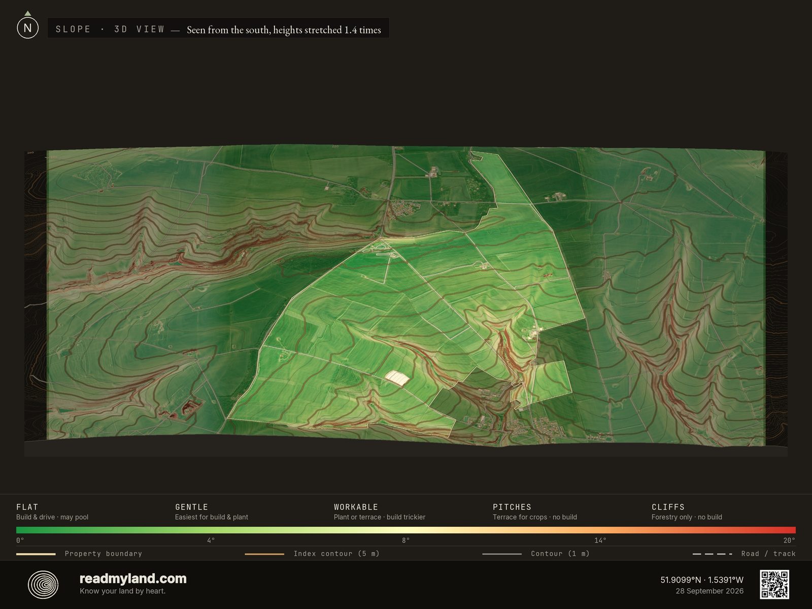
Steepness across the parcel. Flatter ground is easiest to build and cultivate, here 97% sits under 12°, which is why buildability reads 91, and nearly the whole farm reads as workable cultivable land.

Where the ground breaks, and where it runs smooth
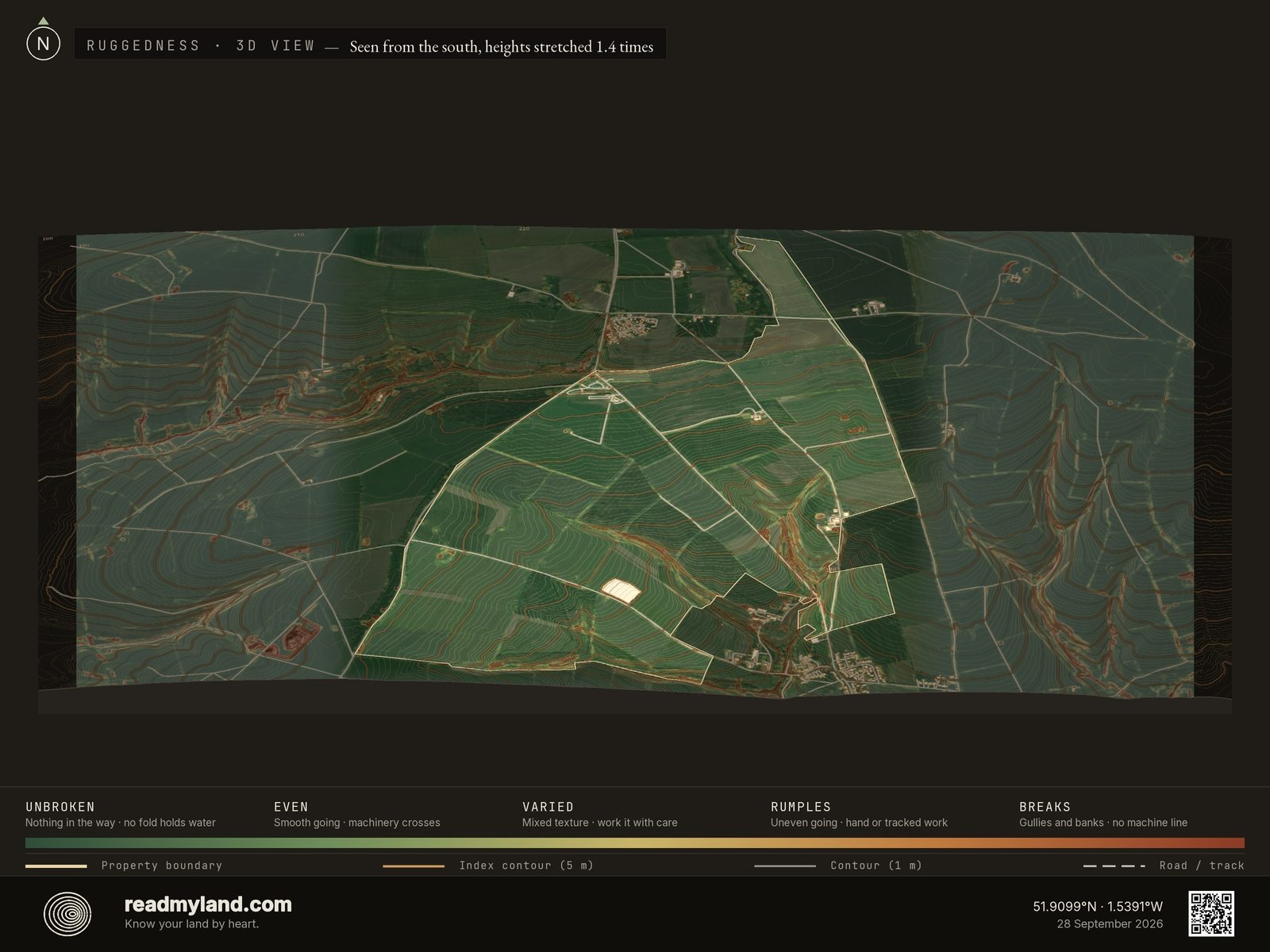
Where the ground surface breaks up rather than how steep it is: gullies, banks, ditches, terrace edges and old track cuttings read in rust, ground that runs smooth reads green. A uniformly steep hillside is smooth ground a tractor works along the contour; gentle land cut with banks often is not, and no slope map tells those apart. Use the green ground for vehicle routes, fence lines and anywhere a tractor has to reach. The colours compare ground within this parcel only.

Which way the land faces
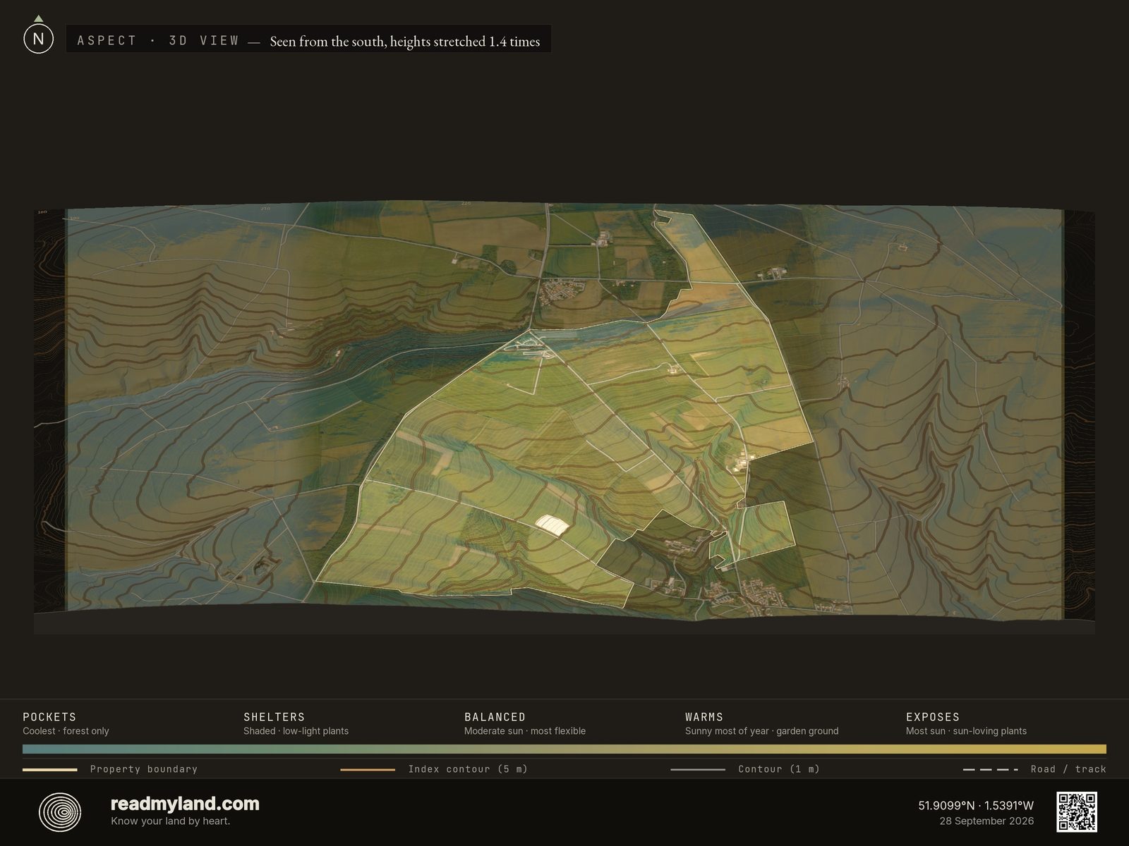
The orientation of each slope: the driver of sunlight and warmth. About 60% of the farm falls inside the arc the solar score treats as favourable here, southeast round through south to west, measured across the whole farm rather than the cropped part of it. Place the kitchen garden and orchards on the south-facing mid-slope.

The landform, lit from a low sun
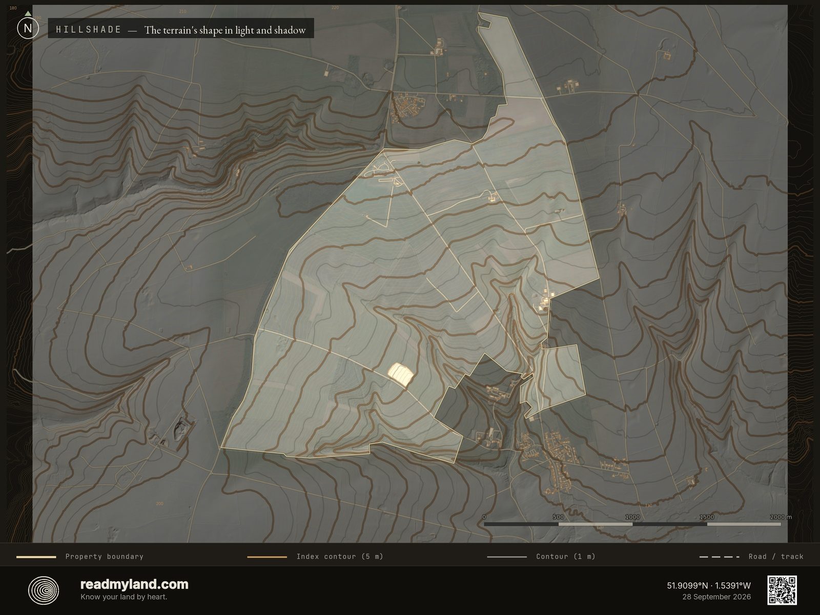
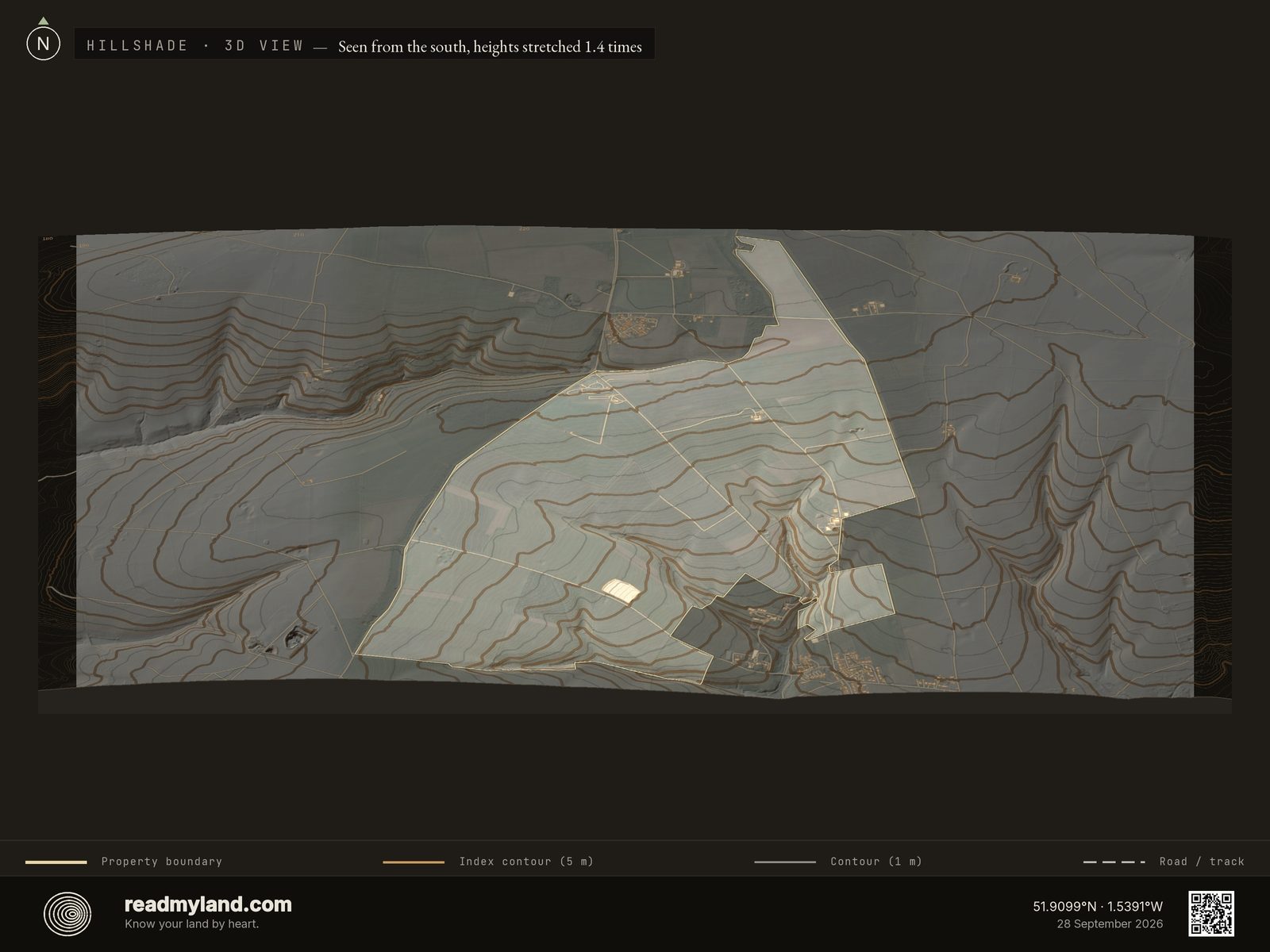
Relief shading with the satellite faded almost out, lit by a low sun. Seen this way the farm is one smooth upland sheet, the rolls are so subtle that the eye goes straight to the edges: the wooded scarp falling away just beyond the northwest boundary, and the branching valley shadowed into the southeast quarter. That valley is the one place where the landform, not the farmer, sets the rules.
Sun, wind, and shelter in one view
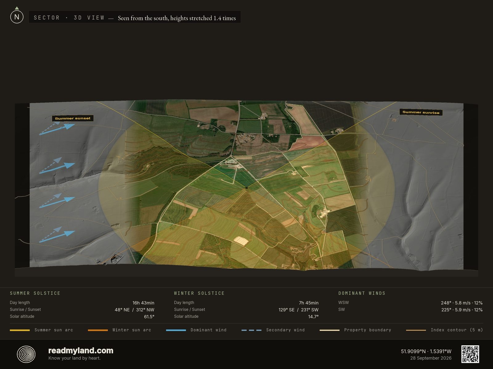
Sun arcs and dominant winds drawn over the farm, with the solstice numbers in the panel: 16h 43min of midsummer daylight against 7h 45min at midwinter, when the sun climbs just 14.7° above the horizon. Both dominant winds arrive out of the southwest quarter, WSW at 5.8 m/s, SW at 5.9 m/s, and this open upland offers them little resistance: the case for keeping and thickening the hedgerows is written right here. Winter sun that low also means anything tall on a southern boundary throws long shadows: worth remembering when siting barns or panels.

What decides the growing
Rainfall, temperature range, frost-free days, growing degree days, and wind in one place. Frost-free window (325 days) and annual rainfall (745 mm) tell you more about productive potential than almost anything else on the farm.
What the land can tell you.
Confidence is a band, not a measurement: each layer is held to the lower of two things — how well its source is curated, and what its resolution can actually resolve at the scale of this parcel. That is why soil and flood both read low here. The national soil map is published at 1:250,000 and the flood model is a global ~1 km grid: both are the best public data covering this ground, and one cell of either is wider than the farm — so read those two rows as regional context, not parcel-level findings.
Every row above is the provider this parcel's dossier actually drew from, not a generic list, and the flood row states the gap rather than hiding it. This analysis is based on 2 m national elevation data, 74 cm orthophotography, and a decade of climate reanalysis. It does not replace parcel-level soil testing, legal due diligence, or factors requiring a site visit: including the Cotswolds AONB planning context. On-site inspection is recommended before purchase or major development. ReadMyLand is not affiliated with Diddly Squat Farm, Clarkson's Farm, or Amazon; this is an independent analysis of a publicly-known location, published as a worked example.
Now read your own land.
Draw any rural parcel and we read it the same way: the 3D map, the five scores and the verdict’s opening, free. No account. The whole parcel, with the complete written verdict, the PDF dossier and the map files, is one payment of €39.
Read your own land →